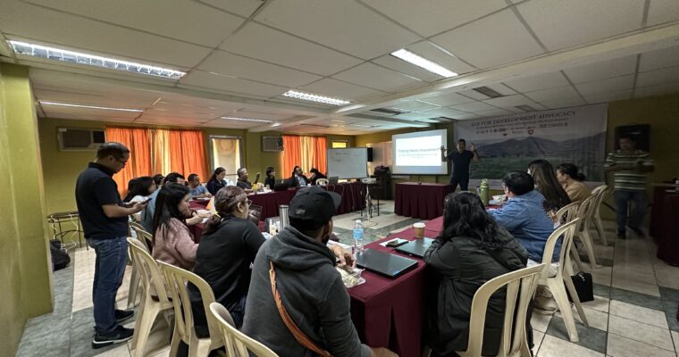
The Asian Farmers’ Association for Sustainable Rural Development (AFA), Pambansang Kilusan ng mga Samahang Magsasaka (PAKISAMA), and the National Land Coalition (NLC) -Philippines, are jointly conducting a capacity-building training on Mapping Tools. The training is supported by the Land Matrix Initiative, with AFA as the regional focal point in Asia and PAKISAMA as the host of the country’s National Land Observatory. The objective of the activity is to improve the capacities in mapping, Geographic Information Systems (GIS ) and Remote Sensing (RS) of Land Rights’ Defender Organizations which can support their respective land rights-related advocacies. It will also serve as a skill-sharing platform on tools, and basics of participatory community mapping.
The 5-day capacity building includes software training on applications such as QGIS, GoogleEarth Pro, Sentinel Hub, and Open Topography to name a few. The lecture will include:
- Philippine Reference Systems: GIS Elements of Standard Maps; Quantum GIS GUI
- Styling spatial data through QGIS map layout tools
- Creation of Different Map Types: Digital Elevation Model (DEM) – Elevation Maps, Land Cover Map
- Watershed delineation and metrics
- Spatial Data 101: Plotting & Georeferencing
The training is being attended by 8 organizations and will run from 13- 17 June 2023 at the Partnership Center (PC), Loyola Heights, Quezon City.
Participant organizations include:
- Asian Farmers’ Association for Sustainable Rural Development (AFA)
- Peoples Campaign for Agrarian Reform Network (AR Now!)
- Center for Agrarian Reform and Rural Development
- Task Force Mapalad
- National Land Coalition Philippines
- Cordillera Peoples Alliance
- Philippine Association for Intercultural Development, Inc.
- Pambansang Kilusan ng mga Samahang Magsasaka (PAKISAMA)
For more information on the project, you may visit www.asianfarmers.org and www.landmatrix.org.


Comments are closed